Augmented Reality Maps & Geographic Data
ARMaps is a easily customizable template for mobile Augmented Reality Mapping applications


ARMaps
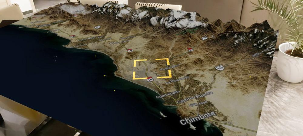
ARMaps is a Unity Project template for a mobile augmented reality (AR) application, with mapping functionalities. The goal was to use cloud functionalities or an API, to retrieve publicly available Geo-data. The user can interact with this data in augmented reality, from a mobile device.
Mobile App


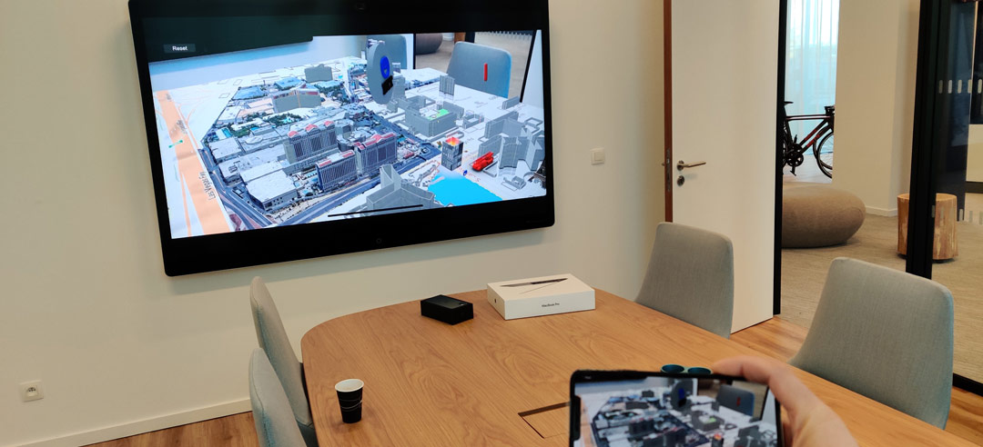
To be able to easily demonstrate the various fields of expertise of NTT – the Client Innovation Center of Europe needed a mobile app which helps to demonstrate the real-world benefits of helping the city of Las Vegas to become a truly smart city.
The result was a mobile augmented reality application which demonstrates various functions of the implemented smart city functionalities, in an abstract way. The user can browse a virtual version of Las Vegas and sees an interactive (3D) simulation of the control panel of this smart city system. The user can interact with various warnings and events to get a clear sense of what is possible with the data of a real smart city.
Responsibilities:
• Scripting (C#)
• Android & iOS support
• Concept Design
• 3D models
Main achievements:
• Multi-platform application
• Using cutting-edge tracking libraries
• Easy to use, low-barrier application
ARMaps
Role Concepting, UX Design, Prototyping, Mobile App Development
Design Adobe XD, Photoshop & Illustrator • Autodesk Maya • V-Ray
Development C# • Unity • ARKit • ARCore • MapBox
Copyright NTT Belgium 2019-2020
Related articles:
This list includes pages and articled dedicated to the specific project and its results, but some links refer to further presentations, recognitions and awards.
- https://hello.global.ntt/en-us/newsroom/ntt-ltd-launches-its-first-client-innovation-center-cic-in-europe
- https://www.telecompaper.com/news/ntt-opens-first-european-client-innovation-center-in-brussels–1317086
- https://www.be.emb-japan.go.jp/itpr_en/news_191120.html
- https://www.emerce.nl/wire/ntt-ltd-opent-eerste-client-innovation-center-cic-europa
